Cyclone Season in Madagascar
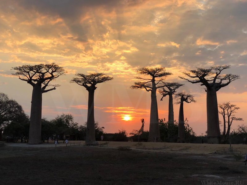
Cyclone season in Madagascar runs from roughly November to April with a peak in January and February, and the east coast and northeast take the worst of it. Storms cut roads, stop ferries, disrupt flights and close several parks outright. The northwest around Nosy Be and the arid southwest see considerably less impact, which is where wet-season itineraries head.
When and Where Cyclones Hit
Cyclones form in the southwest Indian Ocean and track west toward Madagascar, making landfall mainly between January and March with February the statistical peak. The broader season runs November to April.
The east coast takes the brunt, from Toamasina north through Île Sainte-Marie to the SAVA region around Sambava. The northeast around Masoala and Marojejy is comparably exposed.
The central highlands see heavy rain and flooding rather than direct wind damage, with low-lying districts of Antananarivo affected.
The northwest around Nosy Be and Mahajanga sees noticeably less impact, and the arid southwest around Toliara and Tsimanampetsotsa receives little rain at any time of year.
Not every season brings a major landfall, and some years pass with little disruption. The planning question is not whether a cyclone will hit during your specific trip but whether your itinerary can absorb one if it does.
The question is not whether a cyclone will hit while you are there. It is whether your itinerary can absorb one if it does.
What Cyclones Actually Do to a Trip
The practical consequences matter more than the meteorology.
Roads get cut. Recent seasons have severed the RN2 between Antananarivo and Toamasina, which is the route to Andasibe and the east coast. The RN8 north from Morondava floods, closing Tsingy de Bemaraha. Secondary roads to remote parks become impassable.
Ferries stop. The crossing from Soanierana Ivongo to Île Sainte-Marie is unreliable at the best of times and cancels outright in poor conditions. Boat access to Masoala from Maroantsetra stops in rough seas.
Flights are disrupted. Domestic routes reschedule and cancel, and since almost every route transits Antananarivo, a disruption in one place propagates.
Lodges close. Properties in exposed areas shut for the season, particularly on the Masoala peninsula and parts of the east coast.
Infrastructure takes time to recover. Roofs, bridges and roads are repaired after each season, and reconstruction is a permanent condition on the east coast rather than an occasional event.
Which Parks Close
Several protected areas are unreachable or shut through the wet season, and this catches travellers out more than the weather itself.
Tsingy de Bemaraha closes in practice from roughly December to March when the road from Morondava floods and the river ferries cannot operate. Reopening usually falls in April or May depending on how the rains ended.

Baie de Baly and Tsingy de Namoroka in the northwest are accessible only from around May to October.
Kirindy Forest is unreachable from mid-January to late March.
Ankarana’s caves close through the rains from December to April because sudden rainfall raises water levels underground with little warning, and its western sector opens only July to November.
Masoala is often unreachable from January to March when crossings stop and lodges close. Marojejy’s river crossings run dangerously high after heavy rain.
Highest risk. The east coast from Toamasina to Sambava, Île Sainte-Marie, Masoala and Marojejy. Direct cyclone landfall, cut roads, cancelled ferries and closed lodges.
Moderate risk. The central highlands and the RN7 corridor, with heavy rain and flooding rather than wind damage. The western circuit, closed by flooding rather than storms directly.
Lowest risk. Nosy Be and the northwest, and the arid southwest around Toliara and Tsimanampetsotsa. Where wet-season itineraries head.
Travelling in the Wet Season Anyway
Plenty of travellers do visit between December and March, and there are real reasons to.
Prices drop substantially across accommodation, and domestic flights are easier to secure. Crowds disappear entirely, and parks that are busy in October are empty.
Wildlife shifts in your favour for some groups. Reptiles and amphibians are at their most active, night walks become considerably more productive, and the eastern rainforest is at its greenest and richest. Chameleons and frogs that are sluggish or hidden in July are everywhere in December.
The northwest works. Nosy Be and the far north around the Emerald Sea see calmer water and better snorkelling visibility in this window than during the trade wind season.
What makes it workable is flexibility. Travellers with buffer days, no fixed connections and a willingness to change plans do fine. Those on tight schedules through the east do not.
How to Plan Around It
If your dates fall in the cyclone window, several decisions reduce the risk considerably.
Choose the region carefully. Favour the northwest and the arid southwest over the east coast and northeast. Nosy Be with the northern parks is the standard wet-season itinerary.
Build in buffer days. At least two or three across a fortnight, and more if boat crossings are involved. These serve as rest days if nothing goes wrong.

Avoid tight connections. Never plan an international departure on the same day as a domestic arrival, and leave a night in Antananarivo before flying home.
Check road status locally before committing to any drive on the east coast or the western circuit. Operators and lodges know before advisories update.
Buy insurance covering trip disruption as well as medical evacuation, and keep policy details accessible offline since signal disappears at the remote parks.
Monitor forecasts through the Madagascar meteorological service and regional cyclone tracking during the season, and follow guidance from your accommodation or operator, who will know what is happening locally well before any travel advisory updates. If a storm is tracking toward your region, moving your itinerary west or south rather than waiting it out is usually the better call.
What Happens After a Storm
Recovery takes longer than the storm and affects travel for weeks rather than days.
Roads are the slowest to come back. A cut section of the RN2 or a washed-out bridge on a secondary road can take weeks to repair, and temporary crossings are often single-lane and slow.
Ferries resume once the sea settles, which is usually quicker than road repairs. Domestic flights recover fastest of all, though the backlog of rescheduled passengers means seats are scarce for a period afterwards.
Lodges in affected areas reopen on their own timelines, and the small properties at remote locations sometimes stay shut for the rest of the season rather than rebuilding mid-year.
For travellers arriving after a storm rather than during one, the practical questions are whether the roads on your route are open and whether your accommodation is operating. Operators and lodges know before any published source does.
The Longer Picture
Cyclones are part of the reason Madagascar’s eastern forests matter beyond their wildlife. Forest cover on the slopes above the coast slows runoff when a storm dumps its rain, and the deforestation visible along the RN2 is directly connected to the flooding that follows each landfall.
Communities on the east coast rebuild after each season as a matter of routine. Roofs are frequently newer than the walls beneath them, and the colonial buildings that survive at Toamasina have done so through many decades of this.
For visitors this is context rather than a planning factor, but it explains something about the east coast that a weather chart does not. The reconstruction is permanent, and the forest that would reduce the damage is going.
Travel insurance deserves particular attention for wet-season trips. Policies vary considerably in whether they cover cancellation or curtailment caused by weather, and the ones that do often require the disruption to meet a threshold. Read the wording before buying rather than after a storm, and keep policy details accessible offline since signal disappears at the remote parks.
Frequently Asked Questions
When is cyclone season in Madagascar?
Roughly November to April, with landfalls concentrated between January and March and February the statistical peak. The east coast and northeast are most exposed. Not every season brings a major landfall, and some pass with little disruption to travel.
Should I avoid travelling then?
If your itinerary runs through the east coast, northeast or the western circuit and you have fixed connections, yes. If you have flexibility and favour the northwest around Nosy Be or the arid southwest, it is workable and considerably cheaper. Several parks close outright regardless of where you go.
Which parks close during cyclone season?
Tsingy de Bemaraha from roughly December to March, Baie de Baly and Tsingy de Namoroka accessible only May to October, Kirindy Forest unreachable mid-January to late March, Ankarana’s caves closed December to April, and Masoala often unreachable January to March when crossings stop.
Where is safest during the wet season?
Nosy Be and the northwest see considerably less impact than the east, and the far north around the Emerald Sea has its calmest water and best snorkelling visibility in this window. The arid southwest around Toliara and Tsimanampetsotsa receives little rain at any time of year.
Are there advantages to the wet season?
Prices drop substantially, crowds disappear and domestic flights are easier to secure. Reptiles and amphibians are at their most active, making night walks far more productive, and the eastern rainforest is at its greenest. Chameleons and frogs that hide in July are everywhere in December.
How many buffer days should I build in?
At least two or three across a fortnight, and more if boat crossings to Sainte-Marie or Masoala are involved. Never plan an international departure on the same day as a domestic arrival, and leave a night in Antananarivo before flying home. Buffer days serve as rest days if nothing goes wrong.
What happens if a cyclone hits while I am there?
Follow guidance from your accommodation or operator, who will know local conditions before any advisory updates. Roads may close, ferries stop and flights reschedule. Moving your itinerary west or south rather than waiting it out is usually the better call. Insurance covering trip disruption matters as much as medical cover.
Does the whole country get cyclones?
No. The east coast and northeast take direct landfalls. The highlands see heavy rain and flooding rather than wind damage. The northwest around Nosy Be and Mahajanga sees noticeably less, and the arid southwest receives little rain at any point in the year. Region matters more than dates.
Planning Your Trip
Cyclone season does not close Madagascar, but it closes a specific list of parks and makes the eastern side unreliable. Travellers with flexible dates and a route through the northwest do well. Those with a fixed fortnight through Andasibe, Sainte-Marie and Masoala should look at other months.
Booking Your Madagascar Trip
The safari companies and tour operators listed on this website put trips like this together for a living and know which camps, guides and routes actually deliver. We are an independent guide to Madagascar; we do not book or sell tours ourselves.
When you are ready, arrange your safari, tour or holiday with one of the recognised operators listed here. Tell them your dates and what matters most, and a real person, not a form, will handle the itinerary, park bookings and logistics for you.