The RN7 Route Guide
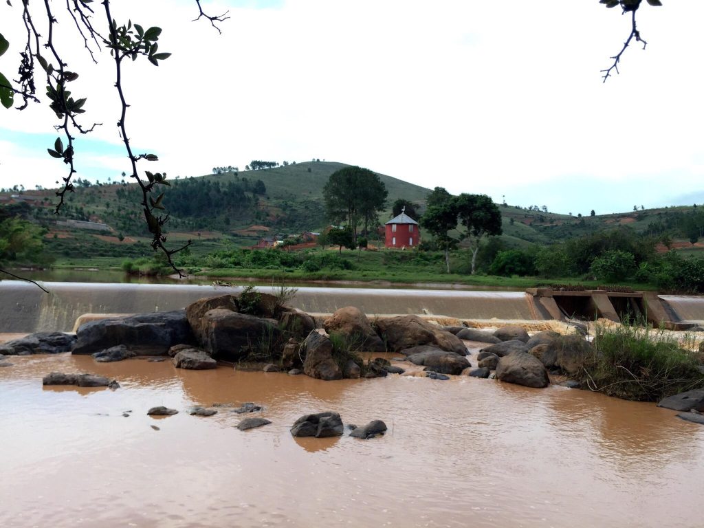
The RN7 runs roughly 950 km from Antananarivo to Toliara and is the only long sealed road in Madagascar, which is why the southern circuit is the country’s standard itinerary. It passes through highland spa towns, the rainforest edge at Ranomafana, ring-tailed lemurs at Anja, the canyons of Isalo and finishes in spiny forest at the coast. This is what to expect stop by stop.
Why the RN7 Defines Madagascar Travel
Everywhere else in Madagascar, the road is the constraint. The western route to Tsingy de Bemaraha takes six to ten hours over unsealed track with two river ferries. The RN44 to Zahamena has two short paved stretches with a long dirt section between them.
The RN7 is sealed the whole way, which is what makes the southern circuit workable in ten days when other regions need flights or a week of driving.
It is not fast. Narrow, winding through the highlands with trucks on gradients, livestock and pedestrians sharing it, average speeds run around 40 km an hour. Antananarivo to Antsirabe is 170 km and three to four hours.
What it delivers is a sequence of genuinely different habitats: highland plateau at 1,500 metres, the eastern rainforest edge, transitional woodland, sandstone canyons and finally spiny forest. Few drives anywhere compress that much variation.
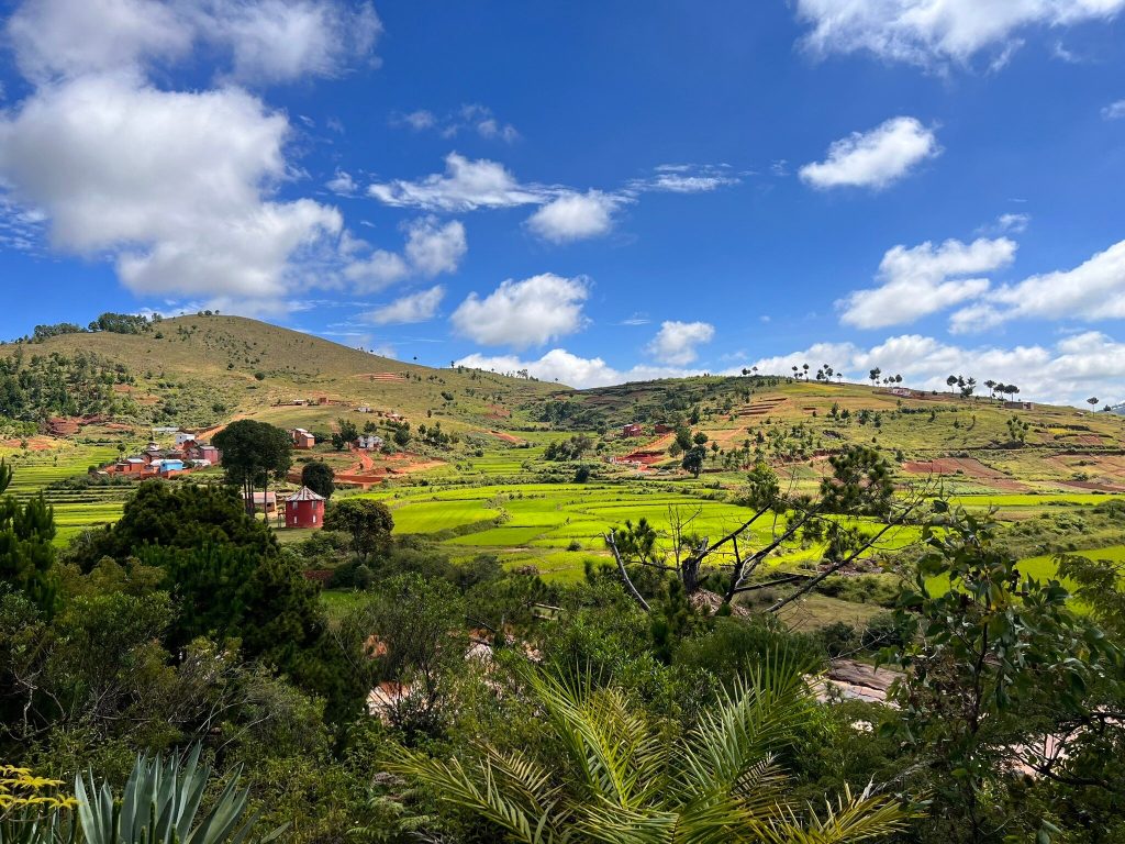
Nine hundred and fifty kilometres, sealed throughout, from temperate highland to spiny desert. The RN7 is why the southern circuit is Madagascar’s standard trip.
Antananarivo to Antsirabe
The first leg runs 170 km south and takes three to four hours, climbing across the highland plateau through terraced rice fields and red-earth villages.
Antsirabe at 1,500 metres is the standard first overnight, a spa town built by the French with wide colonial avenues, Art Deco shopfronts and a cathedral built by Norwegian missionaries. Several thousand hand-pulled pousse-pousse rickshaws work the streets.
Artisan workshops turn zebu horn into cutlery and recycled tin into miniature bicycles, and prices here are the lowest in Madagascar for handicrafts. Lake Tritriva, a collapsed volcanic crater, sits 17 km west.
Nights get genuinely cold from June to August, close to freezing, and hotels rarely have heating. Travellers arriving from the coast are routinely caught out.
Antsirabe to Ranomafana
The longest leg on the route, six to eight hours, and the one where an early start matters most.
Ambositra is the natural lunch stop and the centre of Zafimaniry woodcarving, a tradition recognised by UNESCO, with geometric patterns cut into furniture and panels.
The road then turns east off the RN7 onto the RN25 for the final ninety minutes to two hours to Ranomafana, on a narrow winding road full of blind corners.
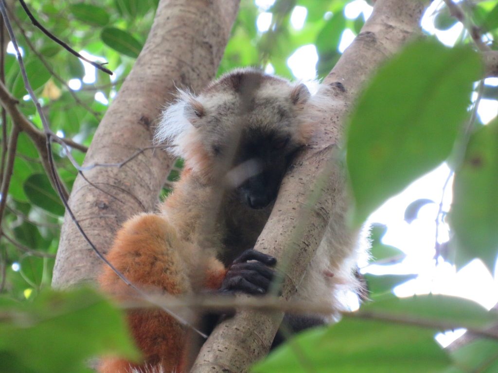
Ranomafana National Park holds twelve lemur species including the golden bamboo lemur discovered here in 1986, over a hundred frog species and some of the best birding in Madagascar. The forest is steep and wet, receiving between 1,600 and 4,000 mm a year.
Two nights is the sensible minimum. The village has thermal springs, which is where the name comes from: rano water, mafana hot.
Fianarantsoa and Ambalavao
Fianarantsoa holds the best-preserved historic quarter in Madagascar, with nineteenth-century brick houses and stone churches climbing a ridge, largely intact where Antananarivo’s equivalent has been altered.
The Sahambavy tea estate 23 km east is the country’s only commercial tea plantation, and the surrounding hills produce Madagascar’s small wine industry. The FCE railway to Manakara departs from here, taking twelve to twenty-four hours and running on its own logic.
Ambalavao, 55 km south, is worth timing for. The Antemoro paper workshop makes paper by a method brought from the Arab world centuries ago, pressing dried flowers into pulp. The zebu market on Wednesdays and Thursdays is the largest in Madagascar, with herders walking cattle up from the deep south.
Worth two nights. Ranomafana for the rainforest and night walks, Isalo for the canyon circuits and sunset. Both repay a full day and a night walk rather than a rushed morning.
One night is enough. Antsirabe, Fianarantsoa and Ambalavao. All are stops rather than destinations, though Fianarantsoa’s old town and the tea estate reward a second day if you have it.
Short stops. Ambositra for woodcarving, Anja for ninety minutes of ring-tailed lemurs, Zombitse for an hour of transitional forest on the drive west. None costs a night.
Anja Community Reserve
Anja sits 13 km south of Ambalavao directly on the RN7 and takes ninety minutes, which makes it the best value stop on the entire route.
It holds the densest ring-tailed lemur population in Madagascar in a patch of forest beneath three granite domes, and the reserve is entirely village-owned and run. Betsileo families formed the association in 2001 when deforestation was destroying both forest and lemurs.
Go early. The lemurs sun themselves on boulders in the first hours of light with arms spread, and by mid-morning in peak season the short circuit fills with coaches.
Longer circuits climb toward the summits with rope-assisted scrambling for anyone wanting more than the standard walk.

Ambalavao to Isalo
Four to five hours south, and the country changes visibly as the highlands drop away toward the arid south.
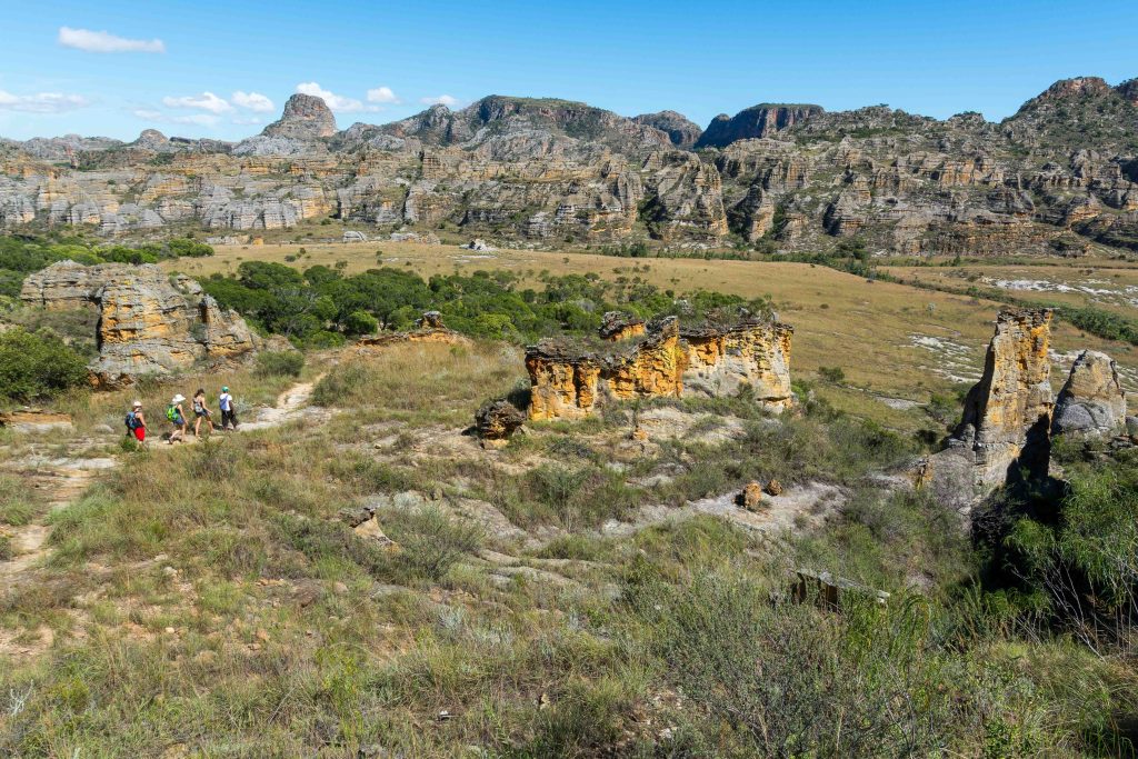
Isalo National Park is Madagascar’s leading hiking destination, built around a Jurassic sandstone massif cut by canyons, spring-fed pools and palm-shaded gorges.
The Piscine Naturelle circuit takes about three hours each way to a clear pool beneath a small waterfall. The Namaza gorge holds the Cascade des Nymphes and a chain of pools. Ring-tailed lemurs work the canyon floors and Verreaux’s sifaka cross open ground upright.
Sunset at the Fenêtre de l’Isalo, the natural sandstone arch, is the standard evening. Two nights lets you walk properly rather than fitting one circuit between drives.
Ranohira is the gateway town where fees are paid and guides assigned, with accommodation ranging from simple guesthouses to the upmarket Jardin du Roy and Relais de la Reine.
Start walks at first light throughout this route. In the rainforest at Ranomafana the wildlife is active at dawn and quiet by mid-morning. At Isalo the exposed plateau becomes punishing by eleven and there is no shade. The single biggest improvement to an RN7 trip costs nothing and involves setting an alarm.
Isalo to Toliara and the Coast
The final leg runs southwest through increasingly arid country toward the sea.
Zombitse-Vohibasia National Park sits directly on the road and takes an hour or two, protecting transitional forest between the humid east and the spiny south. Appert’s tetraka lives here and almost nowhere else, alongside Verreaux’s sifaka and several coua species.
Toliara is where the RN7 ends, the driest and hottest city in Madagascar. It has no swimming beach worth the name, so transfer straight to the coast.
Ifaty and Mangily lie 27 to 30 km north on a rough road with a reef 200 metres offshore. Anakao is an hour south by boat. The Antsokay Arboretum outside the city holds over 900 plant species from the southwest, around 90 percent endemic.
Fly back to Antananarivo from Toliara rather than driving. That single decision saves two full days and is what makes a ten-day RN7 trip work.
Practicalities on the Route
A standard vehicle handles the RN7 adequately, and booking a four-wheel drive for a sealed road is a common way to overspend. The exceptions are the tracks to Andringitra from Ambalavao and the road to Ifaty.
Taxi-brousse connects every town on the route frequently and cheaply, which makes the RN7 the one Madagascar circuit that works entirely on public transport. The friction is reaching park entrances from drop-off points.
Banks and ATMs are reliable at Antananarivo, Antsirabe, Fianarantsoa and Toliara. Draw cash at these rather than assuming machines will work further along, since park fees and guides are cash in Ariary throughout.
Fuel stations are frequent on this route, unlike the west and the remote parks.
Official advice recommends a recognised operator in the southern triangle between Ihosy, Toliara and Fort Dauphin, where dahalo activity has been reported in rural areas, and convoy attacks have occurred on parts of the RN7.

Frequently Asked Questions
How long does the RN7 take?
The full route from Antananarivo to Toliara covers roughly 950 km and needs the better part of a week with park stops. Ten days covers it with two or three parks properly. Fourteen adds a coastal finish and second nights at the major parks. Plan by hours rather than kilometres, expecting averages around 40 km an hour.
What does an RN7 trip cost?
Park entry is 45,000 Ariary per adult per day at most parks with guides charged separately per group, and Isalo reported variously at 45,000 or 65,000 plus tax. Accommodation runs from 20 to 40 US dollars for guesthouses up to 120 for the better lodges. Vehicle hire with a driver is the dominant cost, plus the return flight from Toliara.
Do I need a four-wheel drive?
Not for the RN7 itself, which is sealed the whole way and manageable in a standard car. Four-wheel drive is needed for the tracks to Andringitra from Ambalavao and helps on the road to Ifaty. Booking one for the sealed route is a common way to overspend.
Can I do it by taxi-brousse?
Yes, and the RN7 is the one Madagascar circuit that works entirely on public transport. Services connect every town frequently at around 10,000 to 15,000 Ariary between stops. The friction is reaching park entrances from drop-off points, so many travellers hire a vehicle for the park legs while using public transport between towns.
Which stops need two nights?
Ranomafana and Isalo, both of which repay a full day plus a night walk rather than a rushed morning. Antsirabe, Fianarantsoa and Ambalavao work as single nights, though Fianarantsoa’s old town and the tea estate reward a second day. Anja takes ninety minutes and costs no night at all.
Should I drive back or fly?
Fly from Toliara. Driving the route back retraces 950 km and costs two full days, and the flight is what makes a ten-day trip work rather than feel rushed. Book it early, since domestic capacity is limited and constrains itineraries more than accommodation does.
When is the best time to drive the RN7?
April to November. October is the strongest month overall, with infant lemurs and active reptiles. July and August are cooler and busiest, with genuinely cold highland nights. December to March brings rain that makes the RN25 to Ranomafana slick and the secondary roads difficult.
Is the RN7 safe?
The corridor and the parks along it are travelled constantly and present no unusual difficulty. Official advice recommends a recognised operator in the southern triangle between Ihosy, Toliara and Fort Dauphin, where dahalo activity has been reported in rural areas, and convoy attacks have occurred on parts of the route. Avoid night driving anywhere.
Planning Your Trip
The RN7 rewards pacing over ambition. Six to eight hour driving days between the southern parks mean that treating every stop as a single night produces a trip spent mostly in a vehicle, and the parks that repay two nights are Ranomafana and Isalo.
Booking Your Madagascar Trip
The safari companies and tour operators listed on this website put trips like this together for a living and know which camps, guides and routes actually deliver. We are an independent guide to Madagascar; we do not book or sell tours ourselves.
When you are ready, arrange your safari, tour or holiday with one of the recognised operators listed here. Tell them your dates and what matters most, and a real person, not a form, will handle the itinerary, park bookings and logistics for you.